
Floodplain Management Ordinance and New FIRM MAPPING
City of Wabasha is in the process of amending their floodplain management ordinance and is anticipated to be completed by June. The MnDNR requires that our floodplain ordinance and new update FIRM maps be approved by 7/21/2026.
The New FIRM Maps outline Zones A and AE in Wabasha in the SFHA graphic
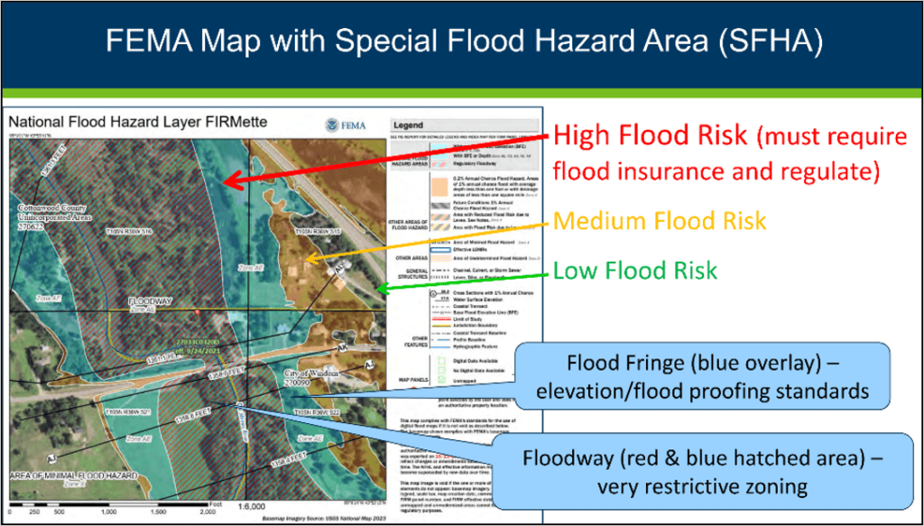
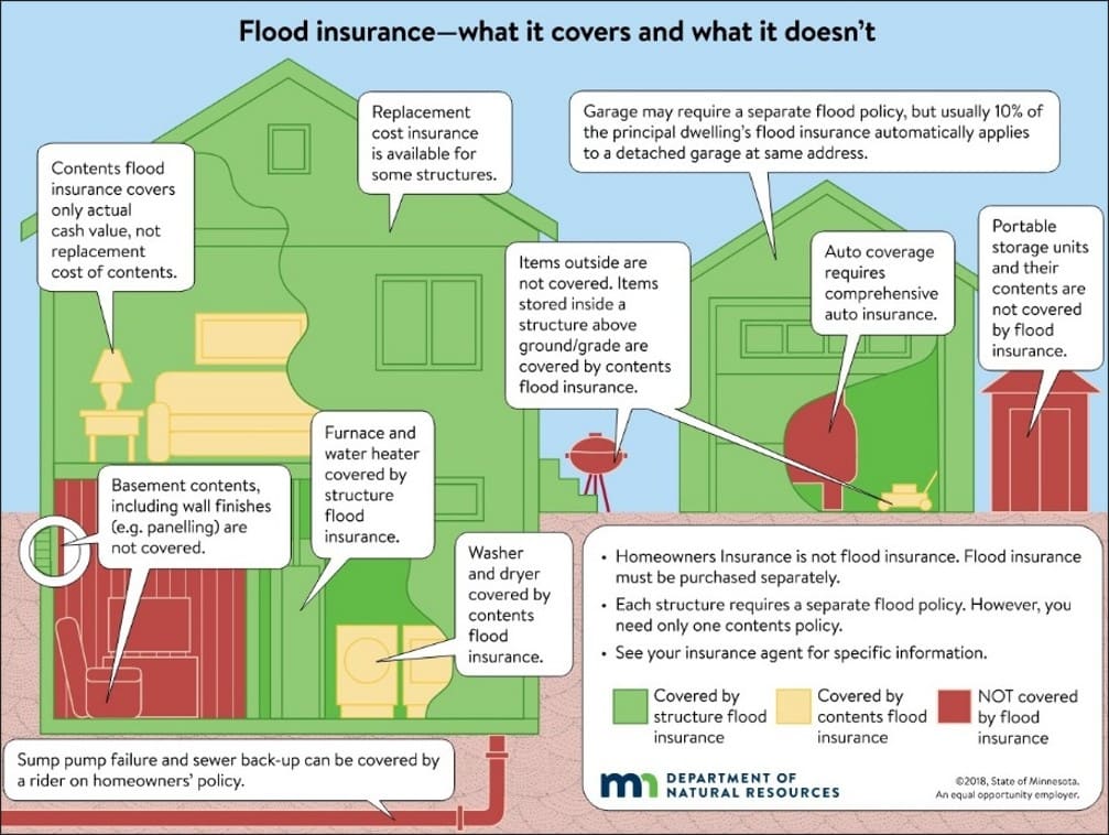
Flood Insurance is Mandatory IF
-
- STRUCTRES are in a Special Flood Hazard Area (SFHA) – A or AE Zone and
- They have a federally backed loan
Most lenders send letters mandating coverage soon after new maps are effective. Many lenders send letters even if the floodplain is just on small, lower parts of your lot.
Floodplain Mapping Resources
-
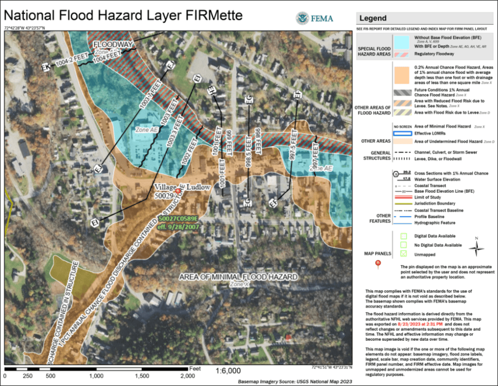
- How to Create a Firmette: (individual property map showing your mapped floodplain areas) fema.gov/sites/default/files/documents/fema_how-find-your-firm-make-firmette.pdf
Firmette can be found here: FEMA Flood Map Service Center | Welcome!
-
- Minnesota DNR Mapping: Floodplain Maps and Technical Resources | Minnesota DNR
- Minnesota DNR Topographic Mapping: MNTOPO
City Contacts
-
- Kristi Trisko, City Planner at 651-363-4971 or Email: City Planner
- City Hall, 651-565-4568 or Email: City Hall
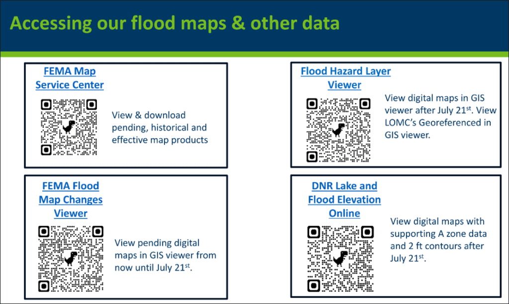
QR Codes to access Mapping